

The terrain is rugged; the climate is subpolar oceanic climate —windy, wet, cloudy, and cool. Temperatures average above freezing throughout the year because of the Gulf Stream.
Between 1035 and 1814, the Faroes were part of the Hereditary Kingdom of Norway. In 1814, the Treaty of Kiel granted Denmark control over the islands, along with two other Norwegian island possessions: Greenland and Iceland. The Faroe Islands have been a self-governing country within the Kingdom of Denmark since 1948.
The Faroese have control of most of their domestic affairs. Those that are the responsibility of Denmark include military defence, policing and the justice department, currency, and foreign affairs. However, as they are not part of the same customs area as Denmark, the Faroe Islands have an independent trade policy and can establish trade agreements with other states. The Faroe Islands also have their own national teams competing in certain sports.
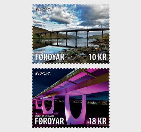
The Streymin Bridge
Streymin Bridge (Faroese: Brúgvin um Streymin; in short Brúgvin), is an important highway bridge in the Faroe Islands. It connects the two biggest and most populous islands of Streymoy to the west and Eysturoy to the east. Crossing the Sundini sound at its narrowest point, it is jokingly referred to as the 'Bridge over the Atlantic', being the only inter-island bridge in the Faroe Islands and one of the few such bridges in the Atlantic Ocean.
The Bridge over Sanda


No comments:
Post a Comment